A buried Roman city, comprehensively mapped
A Roman city called Falerii Novi, buried underground and located 50 kilometres north of Rome, has been fully mapped by a team of archaeologists including scientists from Cambridge University and Ghent University. It is a world first, and not one stone was moved!
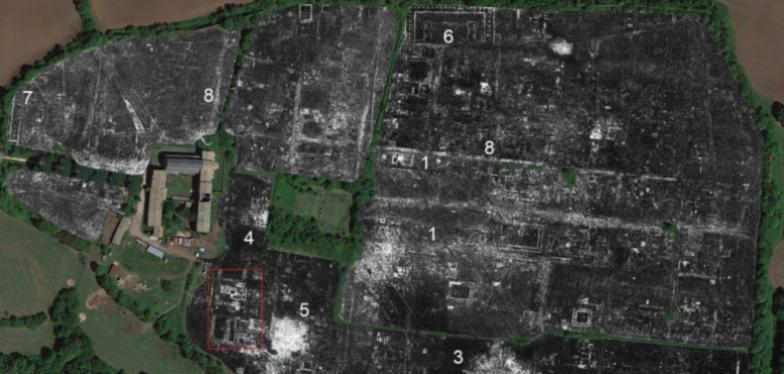
To perform the work, researchers used ground-penetrating radar (GPR) to probe the depths of the 30.5 hectares of Falerii Novi. "This is the first time this technology has been used to map an entire city," explained Martin Millett of Cambridge University. The radar works in a conventional way by using the reflection of radio waves to create images based on the structures it detects. However, recent technological development of GPR now makes it possible to provide better quality images with an extremely impressive level of detail. As such, new information about the city and new buildings were discovered, including a thermal complex, a market, temples, various townhouses and a highly complex water supply network.
This is an important technical breakthrough that researchers believe will change the way Roman urbanisation is understood and transform the way archaeologists investigate urban sites. Nonetheless, GPR technology also poses new challenges due to the enormous amount of data collected, which cannot be analysed manually. New automated techniques based on artificial intelligence will therefore be necessary to process all this information.